Darkness as a spatial planning resource — that was a theoretical concept for most of the 2000s. The Netherlands operationalised it: the donkerte-netwerk (darkness network) identifies priority dark corridors in national nature policy documents, giving formal planning recognition that prevents routine illumination during infrastructure development. Sordello, Busson, Longcore and colleagues formalised this into a named scientific framework in Landscape and Urban Planning (219: 104322, 2022). The EU has not followed. Natura 2000 protects species. It does not protect the darkness those species depend on. That gap is structural, documented, and still open. For the engineering and policy context that frames this discussion, see our guide on how to reduce light pollution.
What Dark Infrastructure Actually Is
Dark infrastructure is a spatial planning category — not a set of lamp specifications, but a deliberately preserved network of unlit land that nocturnal species depend on to move.
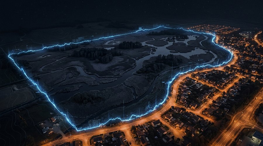
The concept has three components. Core dark zones are the refugia: areas where ALAN is absent or negligible, providing the undisturbed habitat that the most light-sensitive species — Annex IV bats, rare moth assemblages, amphibians — require for roosting and breeding. Dark corridors connect these refugia across the landscape, functioning as the nocturnal equivalent of wildlife underpasses beneath roads: a continuous dark pathway between core zones. Buffer zones form the transition layer — a gradient of progressively reduced illumination at the boundary between core dark zones and developed areas, preventing abrupt light walls that would functionally sever corridor connectivity.
This architecture is explicitly different from municipal lighting zoning. Residential and commercial zones are human-centred categories concerned with glare, amenity, and traffic safety. Dark infrastructure is biodiversity-centred: the question it asks is not how much light can people reasonably expect here, but whether this landscape retains sufficient nocturnal connectivity for the species that depend on it. The two frameworks can coexist — but they require separate instruments, and Europe currently has only the first.
The Dutch Donkerte-Netwerk
The Netherlands developed the most systematic national dark infrastructure framework in Europe — embedded in statutory regional planning documents, not merely advisory guidance.
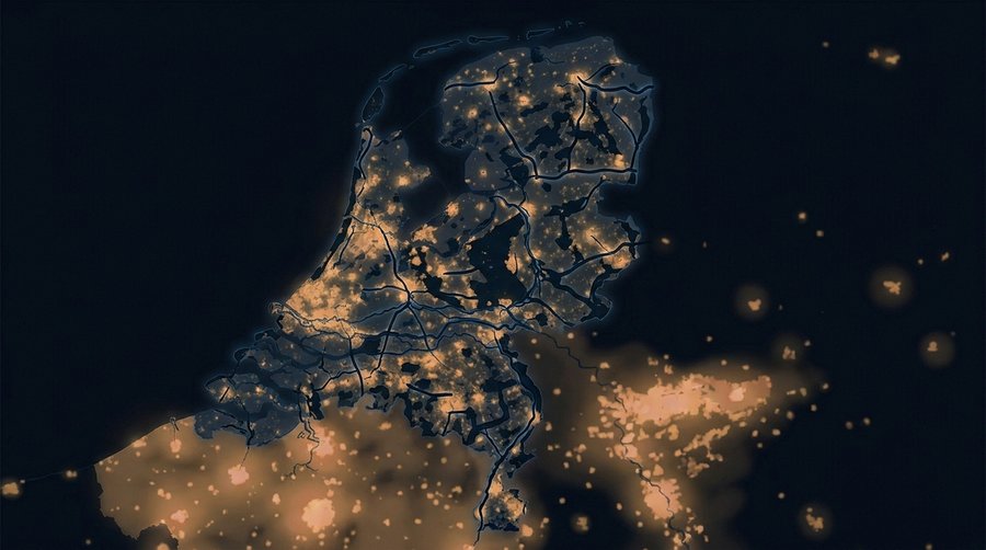
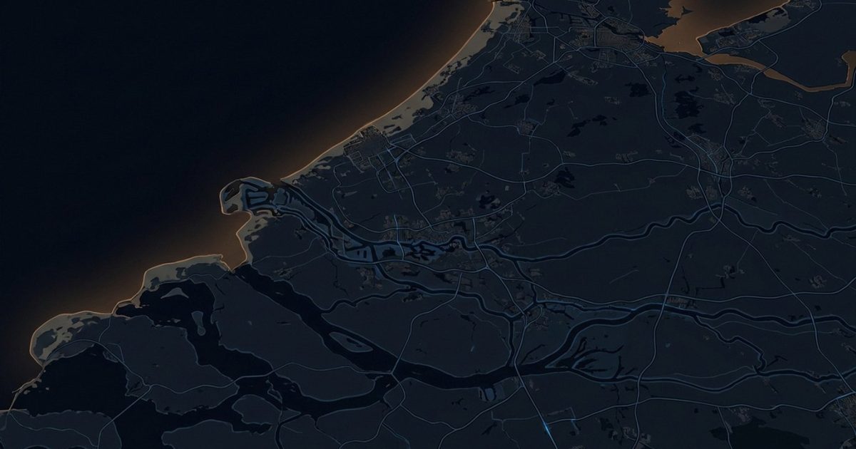
Post-2010, Dutch nature policy began incorporating darkness as an explicit landscape attribute. The mechanism was the Provinciale Omgevingsvisies — regional spatial vision documents produced by each of the twelve Dutch provinces. Several provinces, led by Friesland and Groningen in the north and Zeeland on the coast, began designating donkerte-netwerk areas: mapped networks of priority dark corridors with formal recognition in the provincial plans. The categories reflect the main ecological corridor types: coastal dune and Waddenzee tidal systems, river floodplain corridors along the Maas, Waal, and IJssel, and agricultural margin strips buffering major nature reserves.
The operational consequence matters. Infrastructure projects — road widening, industrial estate expansion, wind energy installations — that are sited within or adjacent to designated donkerte-netwerk zones must complete a light-impact assessment as part of the environmental permitting process. The outcome can require route modifications, mandatory curfews on construction lighting, or permanent design requirements for shielded low-intensity fixtures. The Waddenzee — the tidal mudflat system protected under both the EU Birds Directive and the Ramsar Convention — has been the most visible test case. Offshore energy expansion and harbour developments along the Waddenkust have been subject to dark-impact review procedures that would not have existed without the provincial donkerte-netwerk designation.
This is not a perfect system. Shell’s gas extraction platforms in the Dutch North Sea continue operating under their own permit frameworks with limited integration into the coastal donkerte-netwerk. Industrial expansions along the Rotterdam corridor have in practice received more permitting flexibility than the provincial visions implied. But the framework exists in formal planning documents, survives changes of provincial government, and has been referenced by Dutch courts in permitting disputes. That institutional embedding distinguishes it from every comparable framework in Europe.
The Sordello 2022 Framework
Sordello, Busson, Longcore and colleagues turned a national planning practice into a named scientific framework that any EU country could, in principle, adopt.
The 2022 paper — R. Sordello (UMS PatriNat, Museum National d’Histoire Naturelle Paris), S. Busson, and Travis Longcore (UCLA Urban Wildlands Group) among the co-authors — published in Landscape and Urban Planning 219: 104322, defines dark infrastructure as “the intentional preservation or restoration of darkness within spatial planning documents.” The paper’s contribution is threefold. It establishes the definitional boundary between dark infrastructure and lighting regulation: regulation constrains what you can install; dark infrastructure reserves zones where installation is inappropriate regardless of fixture quality. It provides a methodological framework: mapping existing dark networks using VIIRS or SQM data, assessing connectivity through graph-theory corridor analysis, and embedding the results in planning instruments with enforceable status. And it proposes a governance structure — identifying the planning tier at which each element should be anchored for effective enforcement.
The paper is explicitly a “plea for dark infrastructure” rather than a description of something already implemented. The Netherlands provided the closest operational model. The Sordello framework generalises it, quantifies the methodology, and documents why the concept is scientifically defensible as a conservation tool. For the ecological disruption that makes this architecture necessary, see light pollution and wildlife: how ALAN destroys ecosystems and the species-level evidence in light pollution and birds.
Why Natura 2000 Has a Light Gap
EU species protection law protects bats, amphibians, and rare invertebrates. It does not protect the darkness without which that protection is biologically meaningless.
EU Habitats Directive 92/43/EEC lists species under Annex IV requiring strict protection everywhere — regardless of whether they occur in a designated site. No deliberate disturbance of individuals. No damage to breeding or resting places. All 45 European bat species are on Annex IV. Multiple amphibian species. Several moth and beetle taxa whose larval habitats depend on undisturbed dark conditions.
ALAN demonstrably disturbs Annex IV species. Myotis daubentonii, Rhinolophus ferrumequinum, and all other light-averse bat species abandon commuting routes that are illuminated — documented in controlled Dutch motorway trials and multiple UK corridor studies. Longer detours, reduced foraging efficiency, and in lactating females, directly reduced pup survival. This is disturbance under the Directive’s own definitions.
The Directive’s Annex I habitat types include no light-parameter criteria. A semi-natural dry grassland classified as Annex I habitat can receive a standard-specification LED streetlight on its boundary without triggering any Habitats Directive assessment, because luminance, CCT, and ULR are not variables in the Directive’s habitat quality framework. The practical result: a Rhinolophus hipposideros colony roosting adjacent to a Natura 2000 site boundary can have its foraging flight lines severed by a car park lighting installation that complies fully with EN 13201, satisfies all planning conditions, and violates the spirit of the Habitats Directive without technically breaching any enforceable provision. No EU court has challenged this. No Commission guidance has closed it. The bat is protected. The darkness it needs is not.
Emerging EU and National Initiatives
Several EU member states have begun developing dark infrastructure frameworks — none has made it a statutory obligation, but the policy architecture is accumulating.
France, following its Arrêté du 27 décembre 2018 (the EU’s only national outdoor lighting decree with measured results, analysed in our France decree article), has begun developing complementary regional dark-zone frameworks in departmental biodiversity action plans. The recognition that curfews and CCT ceilings alone do not preserve corridor connectivity — if the landscape between compliant fixtures remains fragmented by legacy lighting — is driving this next step. Germany’s LAI 2012 guidelines — Hinweise zur Messung, Beurteilung und Minderung von Lichtimmissionen — reference ecological sensitivity zones in their Immissionsrichtwerte framework, but as advisory thresholds rather than mandatory dark corridors. No Bundesland has transposed this into binding state law, as covered in our EN 13201 analysis.
Belgium’s Walloon Region published a dark-sky strategy in 2023 that explicitly references the Sordello 2022 paper and proposes a regional réseau de noirceur mapping exercise — a direct conceptual translation of the Dutch donkerte-netwerk. Catalonia’s Llei 6/2001 created lighting protection zones that, in their strictest category, function as dark infrastructure zones by prohibiting new outdoor lighting installations entirely. At EU level, the LIFE programme has funded pilot projects exploring ALAN reduction in Natura 2000 contexts — producing documented protocols for corridor mapping and lighting retrofit in protected areas, though at small geographic scale relative to the problem.
What Implementation Actually Looks Like
Dark infrastructure is not expensive. The Dutch and German case studies show it is often cheaper than standard lighting — because fewer fixtures are installed, not because fixtures are replaced.
Schiermonnikoog, the smallest inhabited Wadden island, was designated as a dark sky area in 2016 as part of the broader Waddenzee UNESCO World Heritage landscape management. The designation involved no major infrastructure spending: existing streetlighting was retrofitted to amber full-cutoff fixtures (590 nm, BUG U0-rated) on the island’s two small settlements, curfews were applied from midnight, and the surrounding tidal and dune areas were maintained strictly unlit. Monitoring in the following seasons documented measurable increases in nocturnally active shorebird species using the dunes for roosting — species that had been consistently absent from the lit corridors.
A Dutch motorway corridor trial along the A2 replaced white LED streetlights over a 10-kilometre section with amber alternatives (2200 K, full cutoff). Bat monitoring using Anabat Express detectors documented a 54% reduction in the barrier effect for Pipistrellus species within weeks of the switch. The amber fixtures cost 10 to 15% less per unit than the white LED equivalents at procurement — fewer lumens required to meet road class specification when ULR waste is eliminated. Darkness is not the absence of a decision. It is an active choice — and in several documented cases, a cheaper one than its alternative.
The technology for all of this is available off-the-shelf. Amber-LED full-cutoff fixtures meeting donkerte-netwerk corridor requirements are catalogue items from standard European lighting suppliers. Implementation costs at pilot scale have run 15 to 40% below equivalent standard-specification retrofit projects, primarily because the dark infrastructure approach specifies fewer fixture installation points from the outset. The obstacle is not engineering. It is the absence of a planning obligation that requires the question to be asked.
Frequently Asked Questions
What is dark infrastructure in simple terms?
Dark infrastructure is the deliberate preservation of darkness as a planning resource — the same way green infrastructure preserves parks and habitat corridors. It identifies specific landscape networks — river banks, forest edges, coastal dunes — where artificial light should not be installed, so that nocturnal species can move between core habitats without crossing lit terrain they will not enter. The Dutch donkerte-netwerk is the most developed national example. Sordello, Busson, Longcore and colleagues formalised the concept in Landscape and Urban Planning 219: 104322 (2022).
Which EU countries lead on dark infrastructure planning?
The Netherlands leads, with the donkerte-netwerk embedded in provincial spatial vision documents (Provinciale Omgevingsvisies) that give it formal planning status. France is developing complementary dark-zone frameworks alongside its 2018 lighting decree. Belgium’s Walloon Region proposed a réseau de noirceur mapping initiative in 2023. Catalonia’s Llei 6/2001 created strict lighting protection zones that function as dark infrastructure. No EU member state has made dark infrastructure planning a statutory obligation.
How does dark infrastructure differ from a Dark Sky Park?
A Dark Sky Park is a designated area certified for its existing low sky brightness — valued and protected after the fact. Dark infrastructure is a prospective planning instrument: it identifies and reserves dark corridors before development eliminates them, preventing loss rather than certifying what remains. A Dark Sky Park can sit within a dark infrastructure network, but most dark infrastructure corridors are not scenic stargazing destinations — they are unspectacular agricultural margins or roadside ditches whose darkness matters to Myotis bats and noctuid moths, not tourist boards.